How to look for records of... Maps and plans
How can I view the records covered in this guide?
How many are online?
- Some
Contents
- 1. Why use this guide?
- 2. The span of the collection
- 3. Understanding our maps and how they are arranged
- 4. How to search for maps
- 5. Local maps and plans
- 6. Ordnance Survey maps
- 7. Railway company and transport maps
- 8. Military maps
- 9. Overseas maps
- 10. Published maps
- 11. Related national archives and libraries with map collections
- 12. Further reading and sources of information
- Appendix: Maps extracted from documents and other map series
1. Why use this guide?
Use this guide for advice on how to find individual items among The National Archives prodigious collection of maps of the British Isles and places around the globe. Much of the advice can also be applied to finding plans of buildings, fortifications, civil engineering projects and architectural layouts of numerous other kinds – but for more detailed, targeted advice on finding plans see our guide to architectural drawings. Our collection of maps and plans is estimated to number over six million items. For a more succinct overview of the maps collection see our maps exhibition pages.
To see the maps or plans themselves you will need to visit us or request copies to be sent to you (). Only a tiny minority of them are available to view online.
The National Archives is not an official place of deposit for published maps, and though we do hold a large number of them, if you are searching for a published map, including published Ordnance Survey maps, you should start your search at a legal deposit library such as the British Library.
For advice on finding Admiralty maps and charts, see our guide to sea charts.
2. The span of the collection
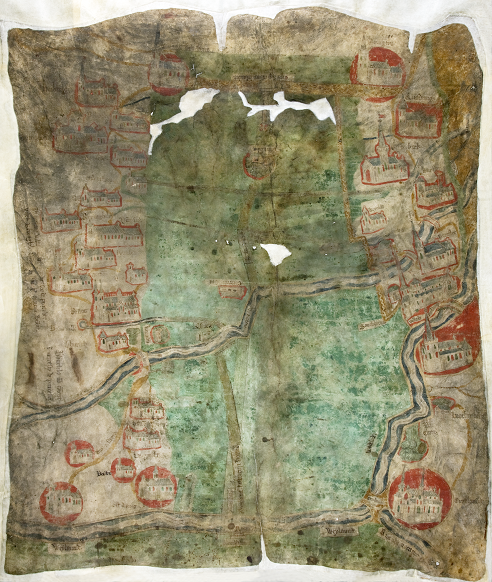
This map from our collection dates from around 1430 and depicts Holland Fen in Lincolnshire (catalogue reference MPCC 1/7).
The National Archives holds central government and court records that have been selected for permanent preservation. Our maps are among these records, and most, broadly speaking, have played a part in the working life of their government department, agency or law court of origin, though some were inherited or acquired in some other way. They reflect countless areas of government and court business, including:
- surveys of numerous kinds
- landholdings of the Crown and government
- taxation policy and collection
- public transport undertakings
- public utilities projects
- cases of litigation relating to land
- military conflicts and campaigns
- British interests overseas
Our oldest maps date back to the medieval period but the bulk of the collection is from the 17th to 20th centuries. Our most recent maps date from around twenty years ago.
Broadly speaking, we hold more maps of areas within England and Wales than Scotland and Northern Ireland (or, before 1922, the whole of Ireland). Our holdings do include maps with large-scale local detail but, in general, for maps of local areas the best place to start is a local county or metropolitan archive. We also have maps of estates, large and small, though, again, The National Archives is not normally the best place to start a search for such material, except for maps of Crown estates.
We hold many maps of places outside the British Isles, covering most areas of the world. However, records and maps once held by the India Office, including those of India, Pakistan, Burma and Bangladesh, are now held at the British Library.
Watch our Spotlight On: Maps video for a brief introduction to maps at The National Archives.
3. Understanding our maps and how they are arranged
As with all the various types of records held at The National Archives, our maps are arranged not according to theme or geographical area but according to the government department or court of law which created or acquired them. Rather than a single coherent collection of maps, it is more accurately a vast and varied assortment of tens of thousands of smaller collections and individual items.
Most of the maps held here have been transferred with the despatches, reports, files or other papers with which they were originally associated in the course of departmental business. These can be tricky to find though many have been identified in our catalogue. There is more advice on this in section 4.
To understand and interpret many of our maps it often helps to also review the text-based records that invariably accompany them.
3.1 Collections created by government departments
A few government departments created their own collections of maps which have subsequently been transferred to The National Archives in discrete record series and as such they are relatively easy to locate. For some departments, such as the Ordnance Survey, Tithe Commission and the Valuation Office, maps were at the very heart of the business in which they were engaged. The Colonial Office, Foreign Office and War Office acquired so many maps that they created their own map collections. In all these instances it is also relatively easy to say which series of records you can expect to find maps in and we provide links to the major collections in subsequent sections of this guide.
3.2 Collections created by The National Archives (and Public Record Office)
The National Archives (and its predecessor the Public Record Office) has itself created record series that consist entirely or largely of maps and plans, drawn from a wide variety of departments (they are listed in the appendix of this guide). Most of these series have been created by extracting maps from the documents with which they were originally held. In some instances these were documents from one coherent series, in other instances they were from a variety of different series and departments. This is done primarily as a preservation measure, usually because each item exceeds the overall size of the parent document of which it formed a part. So that the link between the map and the parent document is not lost, a ‘dummy’ sheet is inserted in the parent document, briefly describing the extracted map and giving its new reference (sometimes referred to as a ‘map extract reference’) while the extracted map itself is also endorsed with the reference of the parent document.
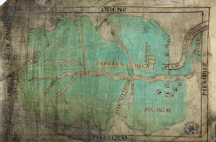
‘Discriptio more sive vasti de Sadgil’: three plans of the moor and waste of Sadgill, Westmoreland (catalogue reference MPB 1/61).
4. How to search for maps
The starting point for most searches at The National Archives is our online catalogue, in which all our records are listed and described in varying degrees of detail. However, some maps are listed in the catalogue in little detail and many others are not listed at all. For a more comprehensive search, and more detailed index descriptions, you will need to visit our building in Kew to consult paper catalogues and calendars. In almost all instances, to see the maps themselves (once you have located references) you will also need to be in our building – though you may be able to request copies of some maps to be sent to you, using our record copying service (). A tiny minority of our maps are available to view online (see section 5.2 and section 9).
Some maps remain unidentified within the records in which they were transferred. To track down unidentified maps, you will need to evaluate which government department might have created or collected them, in what way, and for what purpose.
4.1 Searching for maps using our online catalogue
You can target map series in the catalogue by going to the series references listed in the appendix and the subsequent sections of this guide. However, some series that are described as consisting of ‘maps and plans’ include material which is not, or not strictly, cartographic, such as topographical, architectural or technical drawings, or, less commonly, photographs, posters and other non-textual items.
Many maps are held within files of predominantly written records, so if you can’t find what you are looking for in a map series you may need to search across our entire catalogue (which you can also do using the advanced search option).
4.2 Searching for maps using published catalogues
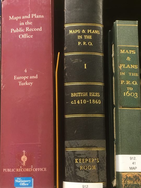
Some of the published catalogues of maps and plans held at The National Archives (previously the Public Record Office).
Four volumes of ‘Maps and Plans in the Public Record Office’ are available in The National Archives reading rooms, as well as in some libraries. These catalogues describe only a fraction of the maps in The National Archives (formerly the Public Record Office) and much of the cartobibliographic information is incomplete. They are, nevertheless, useful finding aids. The four volumes are:
- British Isles c1410-1860 (HMSO, 1967)
- America and West Indies (HMSO, 1974)
- Africa (HMSO, 1983)
- Europe and Turkey (TSO, 1998)
Their contents are arranged topographically under country names in use at the date of publication, and then chronologically within each region, country or place. They contain indexes of draughtsmen, surveyors and cartographers, but not of subjects.
4.3 Searching for maps using the card catalogue
There is a card catalogue, held in drawers in our Map and Large Document Reading Room at our site in Kew. It is arranged topographically, under the names of countries in use at the date of cataloguing. A separate drawer contains a card index to names of draughtsmen, surveyors and cartographers. There is no subject index.
This card catalogue contains information about maps not covered by the published catalogues (see above) as well as maps which have come to light since their publication. The cards list maps small enough to remain in their parent documents. Please note, however, that cards relating to maps extracted from documents and other map series (see Appendix) have been removed and the descriptions entered into our catalogue.
4.4 Searching for maps using the ‘summary catalogues’, ‘draft catalogues’ and calendars
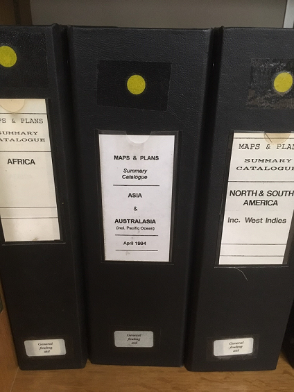
Three volumes of our ‘Summary Catalogues’, located in the Map and Large Document Reading Room at The National Archives in Kew.
A set of maps and plans ‘summary catalogues’, some laid out in calendar form, are available in the Map and Large Document Reading Room at our site in Kew. They provide an index to maps, plans and drawings scattered throughout our collections but not to maps extracted from documents to map-only series (see Appendix). The catalogues provide brief references (though the amount of detail recorded varies) which may relate to just one or a large number of maps. They were compiled in the late 1980s and early 1990s.
These catalogues comprise the following:
- Ten volumes covering the British Isles, arranged by county and country in calendar form
- One volume covering Africa
- One volume covering Asia, Australasia and the Pacific
- One volume covering North America, South America and the West Indies
- Three volumes of subject indexes, covering everything from ‘accidents’ to ‘zoological gardens’, with useful entries such as ‘forests and woods’, ‘harbours’, ‘islands’, ‘rivers’, ‘town plans’ and so on
- Two volumes of draft typescript and manuscript catalogue entries for maps of South-East Asia and Japan
5. Local maps and plans
The best places to start a search for local-area maps are county and metropolitan archives where you may find, for example, diocesan and parish copies of tithe maps, or Valuation Office working plans. You can use our Find an archive tool to get contact details for these local archives or search for map references in their collections using our catalogue (which contains details of collections of over 2,500 archives around the UK).
We do, nevertheless, hold a wide variety of maps that show local detail from around the country, including maps created by the Ordnance Survey (for more on which, see section 6). These historical local maps can be used to identify place names which no longer exists; locate buildings, roads and other features of the landscape that may have changed; and in some instances they document the ownership, value and use of land.
5.1 County maps and town plans
Widely scattered among our records are county maps and plans of towns and cities, some of them very detailed. The series listed below contain significant numbers of these maps and plans.
Click on the reference links to search each series by name of county, city, town or other place name:
- WO 78 – maps from the UK and overseas compiled and collected by the Ordnance Office, the Ordnance Survey and the topographical branches of the War Office and British Army
- MPH 1 – maps from the War Office, many of which were formerly held in WO 78
- MPHH 1 – maps from the War Office, many of which were formerly held in WO 78
- LRRO 1 – maps and plans from the Office of Land Revenue Records and Enrolments
- MPE 1 – maps formerly held by the Office of Land Revenue Records and Enrolments and by the Crown Estate
- MPEE 1 – maps formerly held by the Office of Land Revenue Records and Enrolments
- T 72 – maps and plans of the Municipal and Parliamentary Boundaries Commission
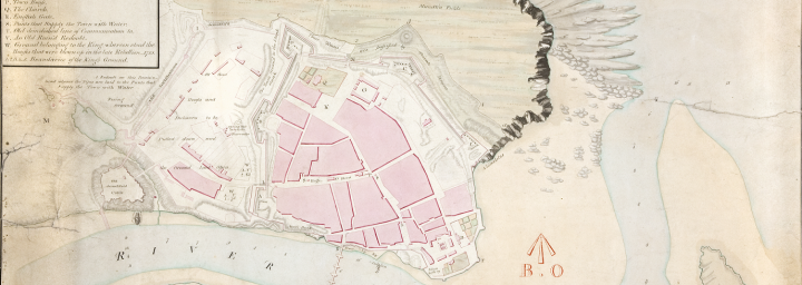
A town plan of Berwick-on-Tweed in Northumberland from 1808 (catalogue reference MPH 1/228/1). This is a cross section of one of four sheets used for military purposes – many of our older town plans were created or acquired for military use.
There are also six series of maps formerly held by the Public Record Office Library which include county, city and town maps, held in the ZMAP department (see section 10).
5.2 1871 census maps
View digital versions of the original registration district maps from the 1871 census (RG 18) on the Cassinimaps () website.
5.3 Estate plans
An estate plan is a large-scale plan showing the property of a single owner or corporate body such as a college or a branch of the military. Often they will include elevations of buildings such as churches and manor houses and are held with documents describing the occupiers or lessees.
Though many estate plans are held in local record offices, we do hold significant numbers here, especially for land owned by the Crown. The following National Archives records departments all hold large numbers of maps of estates which are or were formerly owned by the Crown (department codes are in brackets):
- Crown Estate (CRES)
- Forestry Commission (F)
- Land Revenue Record Office (LRRO)
- Office of Works (WORK)
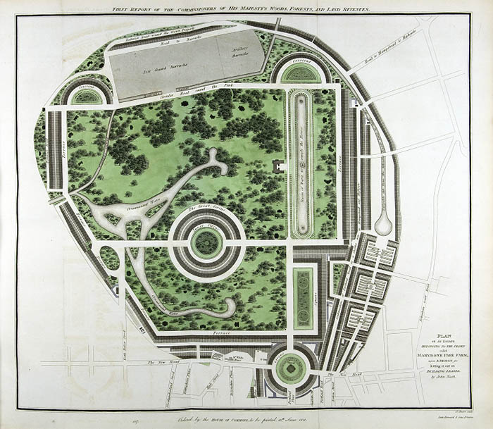
John Nash’s plan of Regent’s Park, a Crown estate originally called Marylebone Park, from 1812 (catalogue reference CRES 60/2).
Other notable sets of estate plans exist within the records of many other departments, among them:
- The Admiralty (ADM)
- The War Office (WO) and the Board of Ordnance division
- The Duchy of Lancaster (DL)
- The Palatinate of Chester (CHES)
- The Palatinate of Durham (DURH)
5.4 Enclosure award maps
Enclosure awards and the maps that accompanied them recorded the ownership and distribution of land and can be used to establish not just the land owners themselves but the extent of the land owned, the rent charge payable on it and local details including roads, rights of way and boundaries. Most of our enclosure maps date from 1800 to around 1850.
For more information see our guide to enclosure awards.
5.5 Tithe surveys
The Tithe Commission, in its work conducting the mid-19th century tithe surveys, accumulated over 10,000 maps of local areas around England and Wales. Most of these were large-scale maps showing significant amounts of detail.
You can view online images of the maps at The Genealogist () online. Search for a place by entering the place name in the ‘Keywords’ field.
Alternatively, for those maps not available online, use the box below to search our catalogue for references to tithe maps (IR30) and apportionments (IR 29) by place name.
For more information see our guide to tithe records.
5.6 Valuation Office Survey, 1910-1915
In the work of the Valuation Office Survey, carried out between 1910 and 1915, thousands of Ordnance Survey map sheets were used, annotated by the surveyors. They provide a detailed picture of the landscape, both urban and rural, and the records that accompany them include descriptions and plans of all kinds of buildings, including private houses.

Cross section of a map of the Mumbles district and other districts in Swansea, Wales, marked up for the Valuation Office Survey (catalogue reference IR 131/9/181).
The maps and records are now held within the 124 series of the Valuation Office. For further detail, see our guide to Valuation Office records.
5.7 National Farm Survey of England and Wales, 1941-1943
The National Farm Survey of 1941-1943 was carried out by the Ministry of Agriculture and Fisheries in response to food shortages and the need to increase productivity during a time of war. The survey covered around 300,000 farms and agricultural holdings and has been referred to as a ‘Second Domesday Book’. Ordnance Survey maps were used as a base for the survey. Handwritten detail was added to these base maps showing where each farm lay, its boundaries and its extent.
See our guide to the survey for advice on how to locate individual maps and records.
6. Ordnance Survey maps
Among the most significant branches of government to have created or acquired large numbers of maps and deposited them here is the Ordnance Survey (OS), the national mapping agency. Although we do hold some maps published by the Ordnance Survey, held in the ZOS department, we are not an official place of deposit for them. Their normal place of deposit is the British Library and the other legal deposit libraries.
Though originally part of the military when it was established in the 18th century, the Ordnance Survey has long been responsible for government surveying and cartographic work of all kinds including work done for local authorities. Its maps, many of them large scale, cover all parts of the United Kingdom.
You can view digital versions of old Ordnance Survey maps and other historical maps at the National Library of Scotland website, which includes English Ordnance Survey maps and maps from around the British Isles, and on commercial websites such as old-maps.co.uk ().
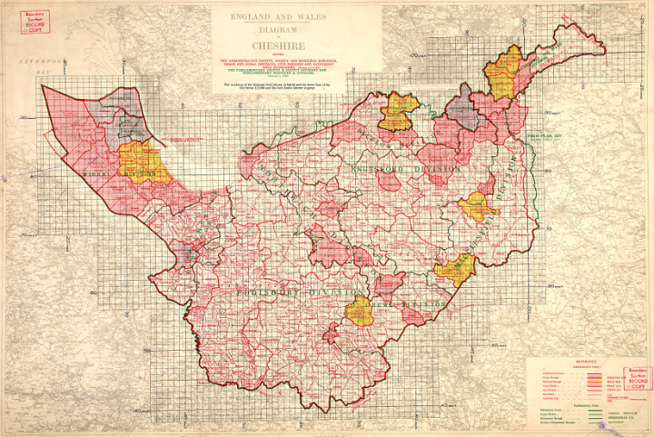
A 1949 map of Cheshire from the Ordnance Survey’s Administrative Area Diagrams Archive (catalogue reference OS 76/204).
The bulk of the OS maps held here are draft and unpublished maps used in the work of the department. Several OS series consist of substantial quantities of OS mapping, often with manuscript annotations or overprinting reflecting their use in the conduct of government business. For more details see our Ordnance Survey research guide.
7. Railway company and transport maps
The records of railway companies prior to the nationalisation of the railways in 1948 are held at The National Archives and include several substantial series of maps and plans, many of which show much detail besides just the railway lines and railway infrastructure that you would expect. Ordnance Survey maps and maps printed by commercial map publishers were used by the railways and include the same level of detail found on any topographical or geographical large-scale map.
Under the Transport Act 1947 the railways, canals, long-distance road haulage and various other types of transport were acquired by the State and operated by the British Transport Commission. Maps and plans of the commission, formerly held among what were known as British Transport Historical Records are now, slightly confusingly, held under railway records references (RAIL) and are as follows:
- RAIL 1029 – plans of proposed and constructed canals and maps of the inland navigation network, but also includes some plans of rivers, wharves and docks.
- RAIL 1030 – principally maps and plans of proposed and constructed railways but includes some Ordnance Survey maps.
- RAIL 1031 – maps and plans of railways and canals but mainly depicted on general maps covering relatively large areas, not maps of individual railway lines. Many show the whole of Great Britain or the whole of England and Wales.
- RAIL 1032 – maps and plans of railway lines formerly held by the Railway Clearing House, a revenue transfer organisation.
- RAIL 1033 – maps, plans and surveys of towns, ports and local areas.
- RAIL 1034 – maps and plans of London and London transport.
- RAIL 1035 – ordnance survey maps, atlases and other general maps as well as station maps.
- RAIL 1036 – maps, plans and surveys from overseas including North American, South American and Japanese railways maps, plus maps of European countries and their railway networks.
- RAIL 1037 – includes sets of Ordnance Survey maps of Yorkshire, Durham, Westmoreland and Cumberland from c.1860 and of other large tracts of northern England from the 19th and early 20th centuries, as well as railway maps from all over the country, but particularly in the north.
- RAIL 1071 – parliamentary deposited plans relating principally to railways but including a few for canals and tramways.
-
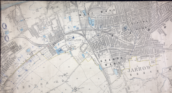
An Ordnance Survey map used for railway planning, showing Hebburn Station near Tyne Dock in north-east England (catalogue reference RAIL 1037/183).
8. Military maps
The National Archives holds multiple thousands of military maps, many of them amassed by the War Office and subsequently the Ministry of Defence. There is a particularly significant collection from the First World War. Large numbers of them are official maps made by or for the British government and armed services, including many trench maps. Others are foreign maps that were acquired and used by the War Office.
There are countless military maps for other wars and campaigns, including the Second World War, though we hold very few separate sets of maps comparable in extent to the First World War maps.
One of the major military map collections, spanning four centuries, is WO 78, an array of over 6,000 sheets, rolls and volumes.
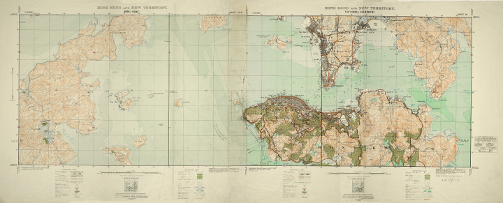
A military survey map of Hong Kong from 1932 (catalogue reference WO 78/5333).
For further detail, see the research guides Military maps of the First World War and Military maps of the Second World War.
9. Overseas maps
We hold maps and plans generated or collected by the various departments of state responsible for the administration of British territories overseas and for the foreign relations of England, Wales and the United Kingdom since the 16th century. These include:
- The State Paper Office (the offices of the Secretaries of State up to 1782)
- The Foreign Office (created in 1782)
- The Colonial Office (created in 1854)
- The Dominions Office (created in 1925)
- The Commonwealth Relations Office (succeeded the Dominions Office in 1947)
- The Foreign and Commonwealth Office (created in 1968)
We hold significant numbers of Irish maps, including a State Papers Ireland collection comprising over 70 maps depicting plantations, fortifications and townships during the reigns of Elizabeth I and James I. Search and download () these early Irish maps (MPF 1/35 to 102) from our website.
Among the most significant of the overseas collections are the records of the Foreign Office and the Colonial Office. Some of the most notable overseas map series are:
Use the box below to search our catalogue, by country or place name for maps and plans from the Foreign Office, Colonial Office and War Office map libraries in FO 925, CO 700 and WO 78.
For more detail about these series and other overseas maps, see our guide to overseas maps and plans.
10. Published maps
Sets of published maps, formerly held in the Public Record Office Library, are held under department code ZMAP. There are six series:
- Miscellaneous maps and atlases in ZMAP 1
- Atlases formerly held by HM Customs in ZMAP 2
- Atlases formerly held by Inland Revenue in ZMAP 3
- Maps of London reproduced by the London Topographical Society in ZMAP 4
- Facsimile reproductions of maps and charts in ZMAP 5
- Ordnance Survey of Scotland maps, 1858-1887, in ZMAP 6
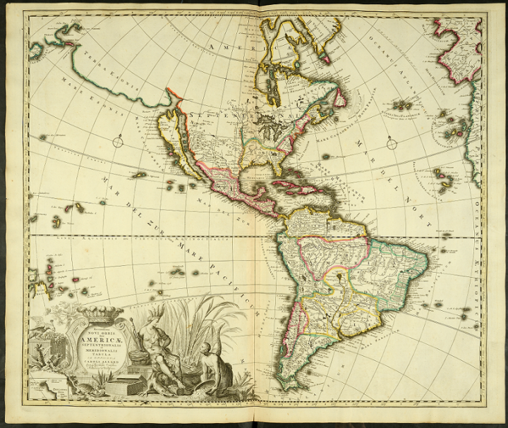
An early 18th century map of America (catalogue reference ZMAP 2/1), one of the published maps held at The National Archives.
See section 6 for details of the published ordnance survey maps held here in department ZOS.
11. Related national archives and libraries with map collections
The following archival institutions and libraries in the UK and Ireland hold collections of maps related, either by provenance or content, to maps held in The National Archives:
- British Library, Map Library – holds vast collections of both manuscript and printed/published mapping, including major holdings of UK Ordnance Survey maps and printed Admiralty charts. It also holds the archives and library of the former India Office.
- National Library of Scotland – more than 200,000 online image of maps of Scotland, England, Wales and beyond plus many more maps in this huge and varied collection.
- National Records of Scotland – holds large numbers of maps and plans.
- Public Record Office of Northern Ireland (PRONI) and the National Archives of Ireland (NAI) both hold records relating to Ireland prior to 1922. From 1922 onwards, holdings of official records are those of the respective governments of Northern Ireland and of the Irish Free State (1922-1949) and Republic of Ireland (since 1949).
12. Further reading and sources of information
12.1 Guides to maps and records at The National Archives
There is no comprehensive survey of National Archives maps, published or among the records. However, some publications, including some published by The National Archives, offer advice on specific records or research topics which include maps. They include:
Geraldine Beech and Rose Mitchell, ‘Maps for Family and Local History’ (2004)
Ian F W Beckett, ‘First World War: The essential guide to sources in The National Archives’ (2002)
J D Cantwell, ‘Second World War: A guide to sources in the Public Record Office’ (rev edn, 1998)
Cliff Edwards, ‘Railway records: a guide to sources’ (2001)
Mary Ellis, ‘Using manorial records’ (1997)
Nick Barratt, ‘Tracing the history of your house’, The National Archives, (2nd edition, 2006)
Janet Foster and Julia Sheppard, ‘British Archives: A Guide to Archive Resources in the UK‘ (4th edn, Palgrave Macmillan, 2002).
12.2 History of maps and mapping
Three publications of general background interest are:
W A Seymour, ed, ‘A History of the Ordnance Survey’ (Dawson, 1980)
Catherine Delano-Smith and Roger J P Kain, ‘English Maps: A History’ (British Library, 1999)
Brian Paul Hindle, ‘Maps for local history’ (B T Batsford, 1998)
12.3 Online sources
See our other online guide to National Archives maps and plans.
A valuable online guide to map holdings in both libraries and archives in the United Kingdom is the Directory of UK Map Collections, maintained by the British Cartographic Society.
A major online gateway to information on the history of cartography, including details about many map collections held in institutions worldwide, is the site ‘Map History/History of Cartography’ maintained by Tony Campbell, formerly Map Librarian of the British Library: maphistory.info/
Read the University of Nottingham Manuscripts and Special Collections guide to using historical maps and plans.
Appendix: Maps extracted from documents and other map series
The table below lists the map series created by The National Archives (and the Public Record Office) by extracting maps from the documents with which they originally existed. For an introduction to these series, see section 3.2.
Some of these series, as the fourth column indicates, contain maps which were drawn from other map series. Nine series of maps were accessioned by The National Archives whose contents were then redistributed into the ‘extracted’ series. In these instances, either the original references (for example, DL 31) or the newly created references (for example, MPC 1) can be used to request and cite the respective maps.
| Department/s from which the maps were extracted | Dates extracted | Catalogue reference | Map series whose maps were transferred to the extracted series |
|---|---|---|---|
| British Transport Commission | – | MPT | |
| Chancery | Before 1989 | MPA and MPAA | |
| Colonial Office | Before 1989 | MPG and MPGG | |
| Court of Common Pleas | Before 1989 | MPL and MPLL | |
| Court of King’s Bench | Before 1989 | MPN and MPNN | |
| Duchy of Lancaster | Before 1989 | MPC and MPCC | Pieces moved to MPC 1 and MPCC 1 from DL 31 (Duchy of Lancaster Maps and Plans) |
| Exchequer | Before 1989 | MPB and MPBB | |
| Foreign Office | Before 1989 | MPK and MPKK | |
| Forestry Commission | Before 1989 | MPO | Pieces moved to MPO 1 from F 2 (Plans of Land entitled to Common Rights under New Forest Acts 1949 and 1964) |
| Office of Land Revenue Records and Enrolments | Before 1989 | MPE and MPEE | Office of Land Revenue Records and Enrolments and predecessors: Associated Departments and successors: Maps and Plans – most pieces from 1 to 3004 were moved to MPE 1, MPEE 1 and MR 1. Pieces subsequently transferred to The National Archives have been kept under their LRRO 1 references |
| Privy Council | Before 1989 | MPQ and MPQQ | |
| State Paper Office | Before 1989 | MPF and MPFF | Pieces moved to MPF 1 from SP 112 (State Paper Office Domestic and Foreign Maps), from pieces 1 to 65 |
| Treasury and Treasury Solicitor | Before 1989 | MPD and MPDD | Pieces were moved to MPD and MPDD 1 from T 62 (Treasury Miscellaneous Maps and Plans Series I) and T 63 (Treasury Miscellaneous Maps and Plans Series II) |
| War Office | Before 1989 | MPH and MPHH | Just under 2000 pieces from WO 78, in the range between 291 and 4996, were moved to MPH 1, MPHH 1 (and MR 1), though a few of these have since been returned to their original WO 78 references (pieces subsequently transferred to The National Archives have been kept under their WO 78 references) |
| Various departments (mainly atlases and maps of unusual form) | Before 1989 | MPZ | The single piece from CRES 33 (The Crown Estate Commissioners’s Windsor Estate Map) was moved to MPZ 1/23 |
| Various departments | Since 1997 | MF | |
| Various departments (maps extracted at the Public Record Office, Chancery Lane) | Between 1989 and 1995 | MFC | Pieces moved to MFC 1 from DL 31 (Duchy of Lancaster Maps and Plans) |
| Various departments (maps extracted at the Public Record Office, Chancery Lane) | 1989-1997 | MRC | |
| Various departments (maps extracted at the Public Record Office, Kew) | Between 1989 and 1995 | MFQ | |
| Various departments (maps extracted at the Public Record Office, Kew) | 1989-1997 | MRQ | |
| Various departments | MR 1 maps extracted before 1989 (all sizes); MR 2 – MR 4 maps extracted since 1997 | MR | Pieces moved to MR 1 from DL 31 (Duchy of Lancaster Maps and Plans); SP 112 (State Paper Office Domestic and Foreign Maps), from pieces 1 to 65; WO 78; T 62 (Treasury Miscellaneous Maps and Plans Series I); and T 63 (Treasury Miscellaneous Maps and Plans Series II) |
| Various departments not assigned an individual map extract prefix | Before 1989 | MPI and MPII | 13 maps were moved to MPI 1/136-148 from BT 9 (Board of Trade Maps – this series was created initially for maps extracted from the series BT 1) |
